Page 1 of 4
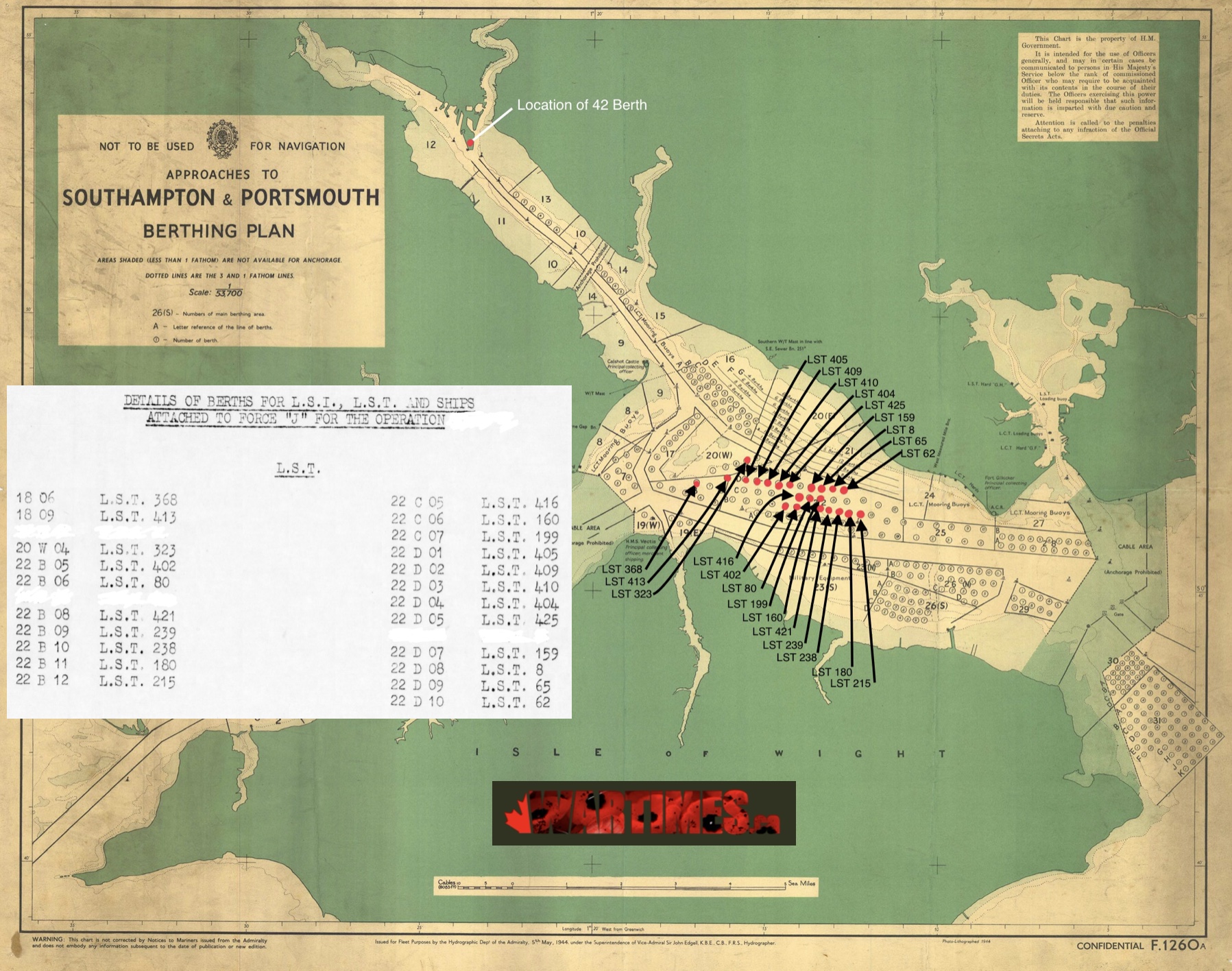
Map of Force’J’ LST Anchorage Positions in Southampton Area
Posted: Tue Dec 03, 2019 11:48 pm
by Temujin
- 77B89342-95DA-406C-90A9-54F70230C1D3.jpeg (861.95 KiB) Viewed 27677 times
Re: Map of Force’J’ LST Anchorage Positions in Southampton Area
Posted: Thu Mar 19, 2020 9:45 am
by CanadianTanker
Temujin, would like to know more about this information. I am trying to locate positions and locations of the First Hussars (6 CAR) for the berthing and then from DDay to D+2. I've done due diligence with archives Canada, Regimental histories etc., but looking for the little gems like this. Please feel free to PM me if you wish.
Re: Map of Force’J’ LST Anchorage Positions in Southampton Area
Posted: Thu Mar 19, 2020 10:01 am
by Temujin
Much of the information your looking for is at this link:
https://wartimes.ca/wp-content/uploads/ ... -v12.4.pdf
Inside that PDF is info like the pages below:
- 2598A8C9-AB76-4C2F-B74C-8E1ABD69B37D.jpeg (314.6 KiB) Viewed 27428 times
- 8C7EA6BF-F0BE-4607-8570-13C81CF37D64.jpeg (269.76 KiB) Viewed 27428 times
- 51E43729-44B2-4971-ADF8-E2743F2F8EA0.jpeg (526.7 KiB) Viewed 27428 times
The “follow on” ships and data are also in the document.
I have NOT plotted the exact location of all the LCT’s on the Southampton/Isle of Wight berthing document, but I can give you the “loading tables” that show where the groups of craft were berths, and it also shows you where they “loaded” (which hands)
As most of these ships sailed directly from Southampton to the Beaches, I can only give you the documents that show the “channel routes” for each of the convoys that the ships would have been in.
I’ll post some of this up next (have to find them in my files)
Re: Map of Force’J’ LST Anchorage Positions in Southampton Area
Posted: Thu Mar 19, 2020 10:16 am
by Temujin
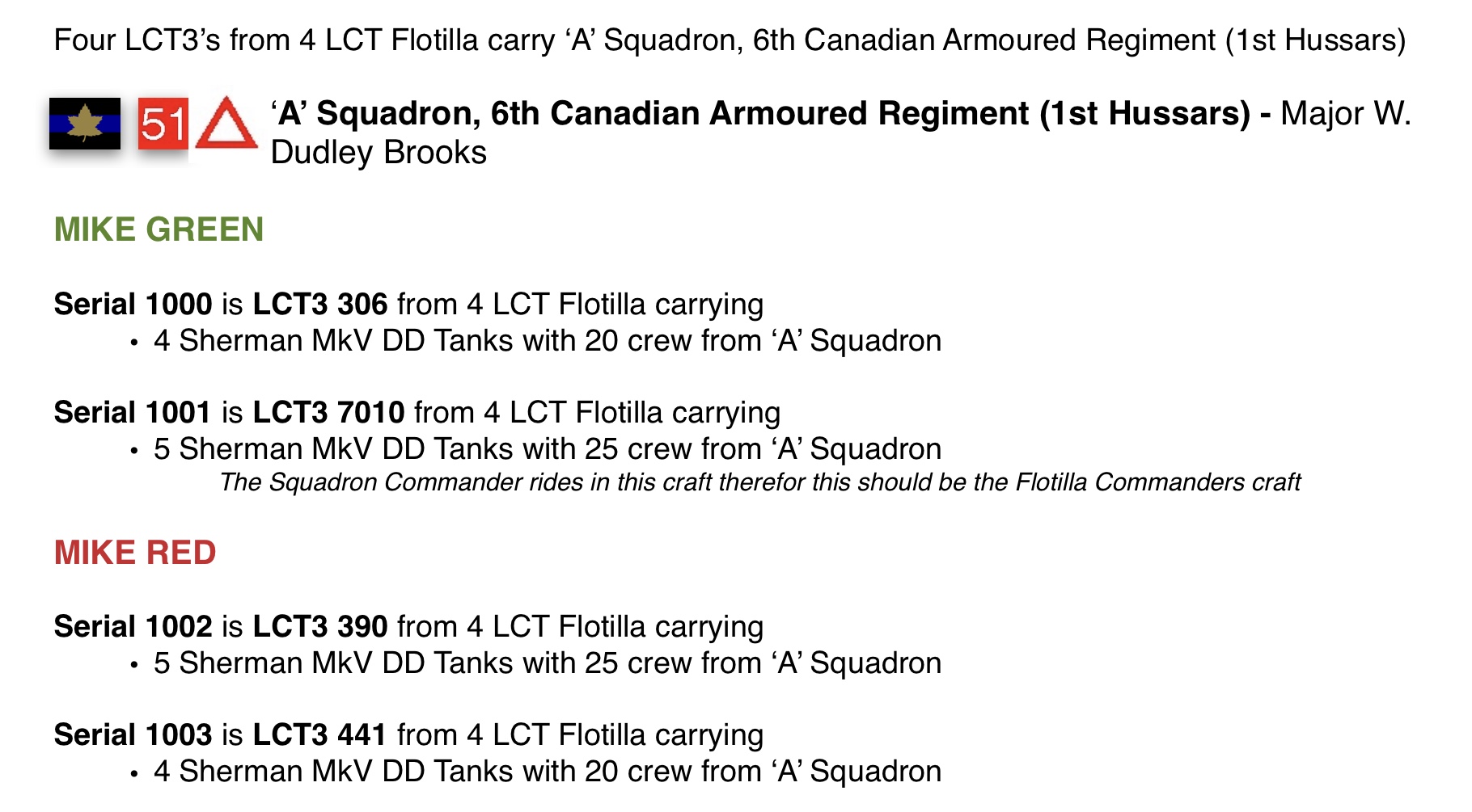
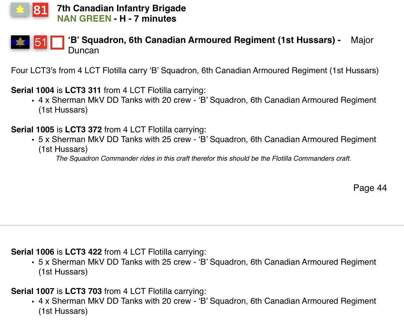
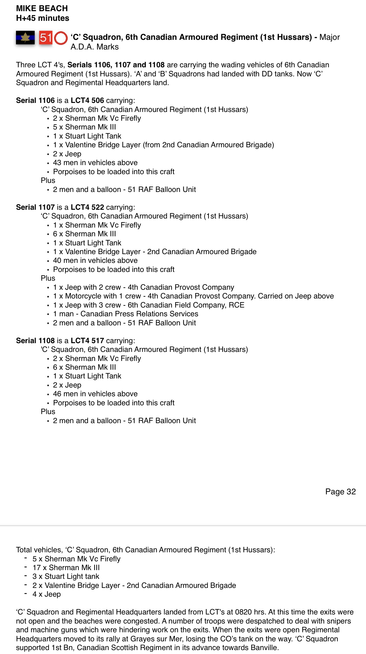
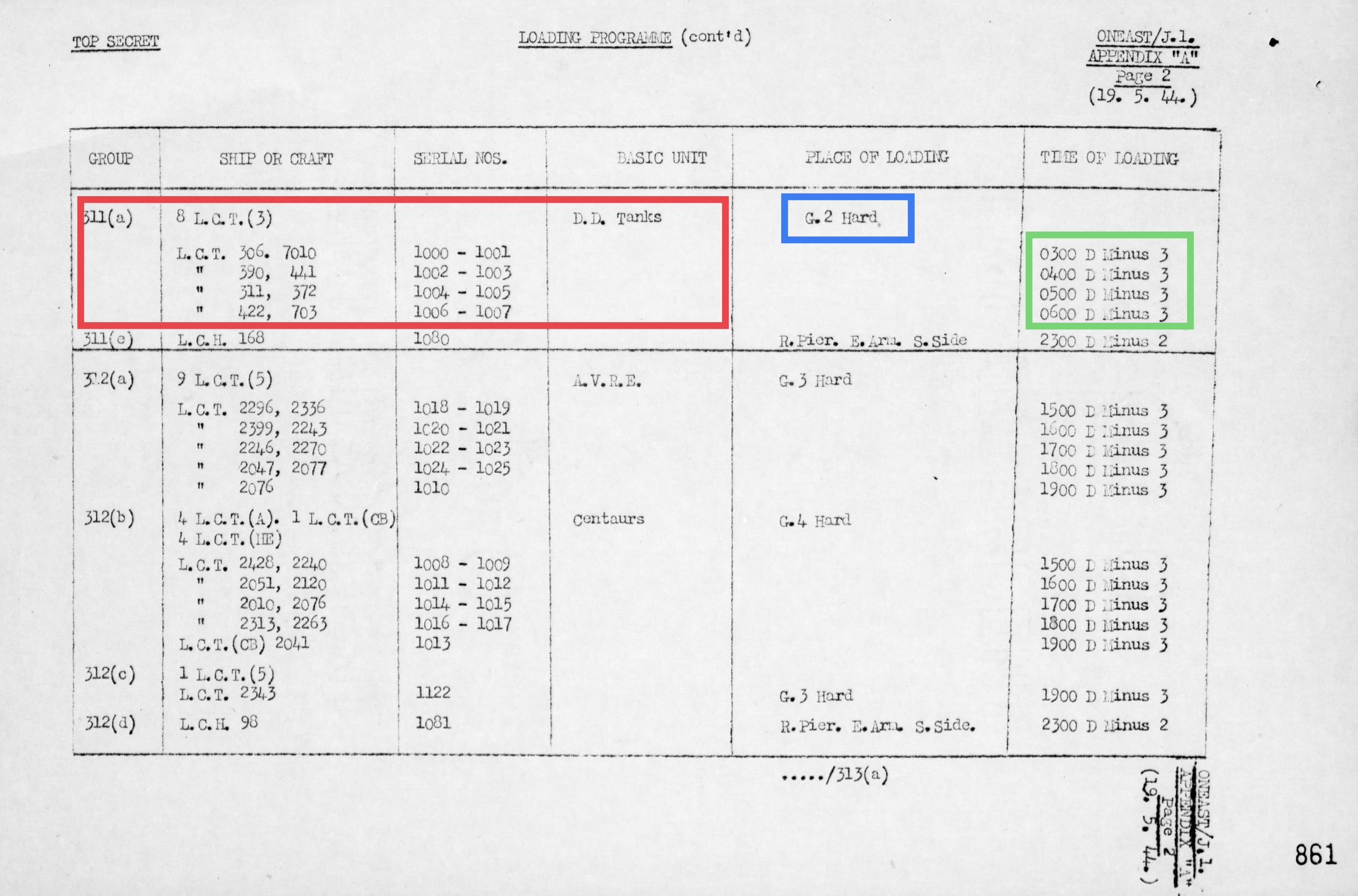
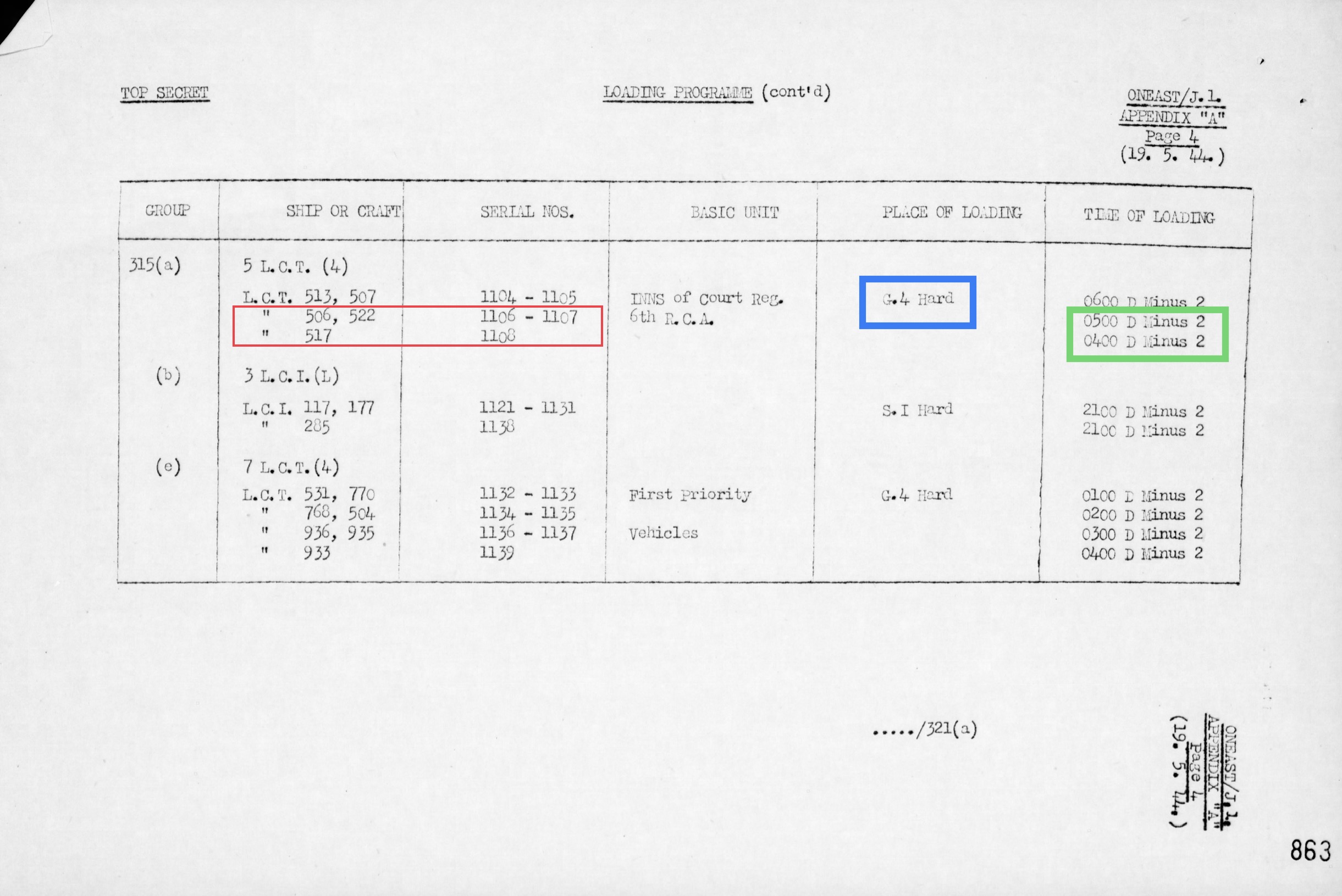
Here’s the landing table that show each of the Serials, where they loaded, and WHEN they loaded.
NOTE: if it says D MINUS 3 for example, this means they load 3 DAY PRIOR to D DAY.......but ALSO REMEMBER, D Day was “planned” for the 5th June, and was delayed 24 hours due to the weather.......so this means that they ACTUALLY LOAD 4 DAYS prior to D Day......etc on the other table
- 36737A27-079C-4AE1-A3C4-9ECB78B815A5.jpeg (624.31 KiB) Viewed 27427 times
- A4E0D387-C50A-4593-966D-2D2183A5B04B.jpeg (505.5 KiB) Viewed 27427 times
Re: Map of Force’J’ LST Anchorage Positions in Southampton Area
Posted: Thu Mar 19, 2020 10:23 am
by Temujin
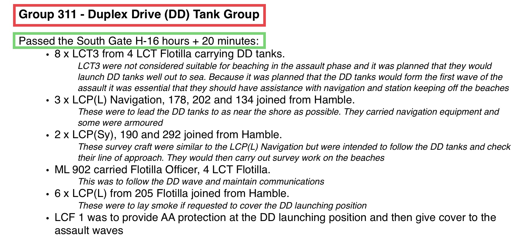
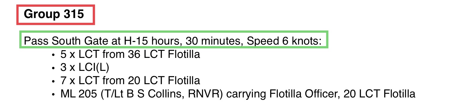
Now these 2 document tell you exactly WHEN the two groups with the 1st Hussars were due to sail.
- 34C79CAE-60A0-4C34-BC5B-F677275CFEC2.jpeg (428.11 KiB) Viewed 27427 times
- 2261F7B6-6AFD-4E67-85E3-A24F67F63F45.jpeg (103.8 KiB) Viewed 27427 times
Re: Map of Force’J’ LST Anchorage Positions in Southampton Area
Posted: Thu Mar 19, 2020 10:33 am
by Temujin
This is one of the Diagrams showing your the route each of the Assault Forces tools to the Beaches, I’ve added and ARROW to show you “FORCE ‘J’” route.
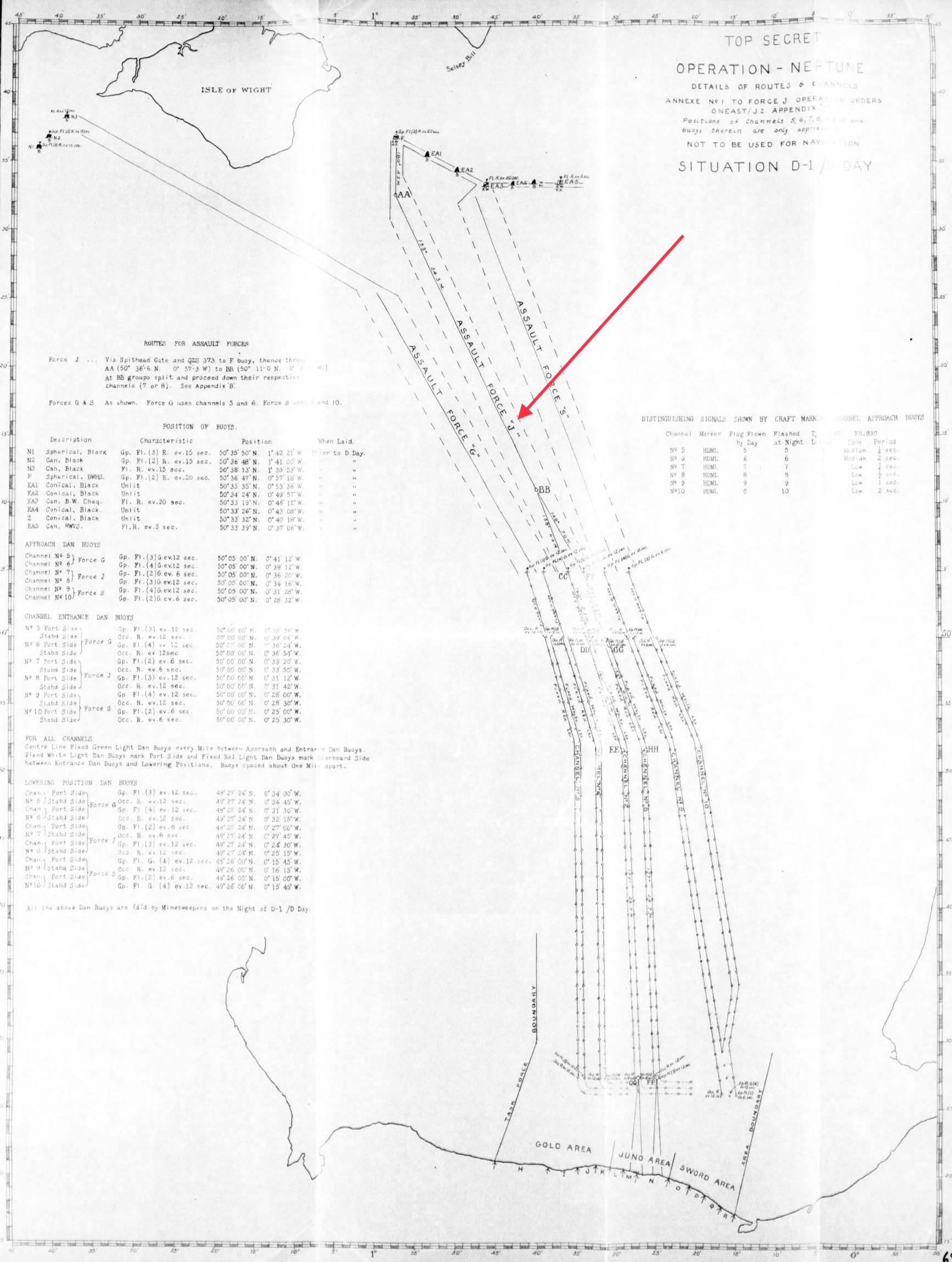
- A8E40F3C-22BE-4EB1-8AFE-31BA4C90E2BA.jpeg (658.44 KiB) Viewed 27427 times
Re: Map of Force’J’ LST Anchorage Positions in Southampton Area
Posted: Thu Mar 19, 2020 10:44 am
by Temujin
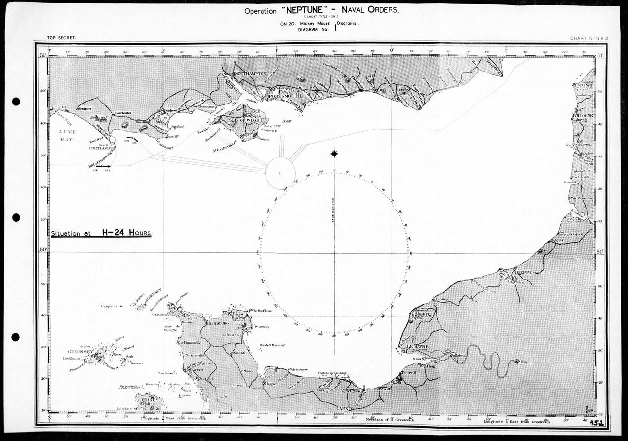
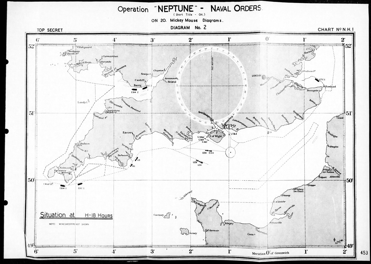
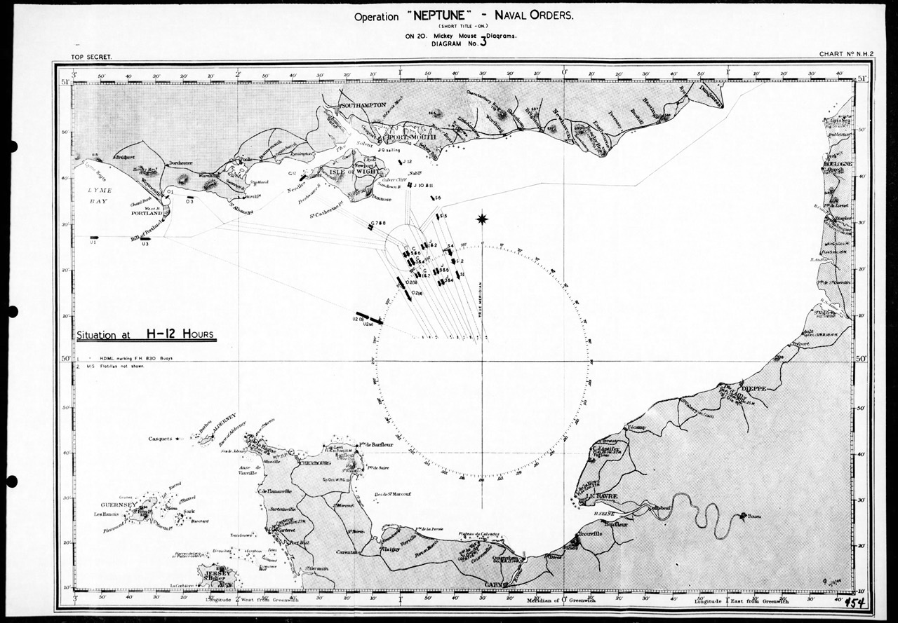
Finally, if you want to KNOW the exact position of each of the Groups as they headed for the beaches, you need to go to the “Mickey Mouse” Diagrams.............YES, THAT’s WAHT THEY WERE CALLED
Each of these pages show you exactly WHERE each of the groups where at a specific hour...........NOTE:, that’s whey they were called Mickey Mouse diagrams......as you could put these pages all together, flick thru them like “cartoons” were made at the time, at the groups would “advance” on the screen so to speak.
I’ve just put a few of the diagrams
THESE AREN’T REALLY CLEAR, AS I HAD TO REDUCE THE SIZE. IF YOU’D LIKE FULL SIZE, LET ME KNOW AND I CAN EMAIL THEM TO YOU.
So, on these diagrams, just look for the groups that have the letter “J” in front, these are FORCE J GROUPS
- 350B9A3F-1751-4043-9AC8-1C300C917337.jpeg (361.65 KiB) Viewed 27425 times
- AF562FA7-D440-41DC-AC8A-4CE063035DE5.jpeg (357.92 KiB) Viewed 27423 times
- 4864C9BE-230E-4AA9-956E-8209122606EF.jpeg (367.3 KiB) Viewed 27423 times

- C096A0DA-0DFF-40AA-ACB7-83EBA95ED650.jpeg (333.33 KiB) Viewed 27422 times
ALL of the Groups STAYED in these channels......as they had been “swept” by the Fleet Minesweepers an bouy’s laid to keep the ships IN their Channels
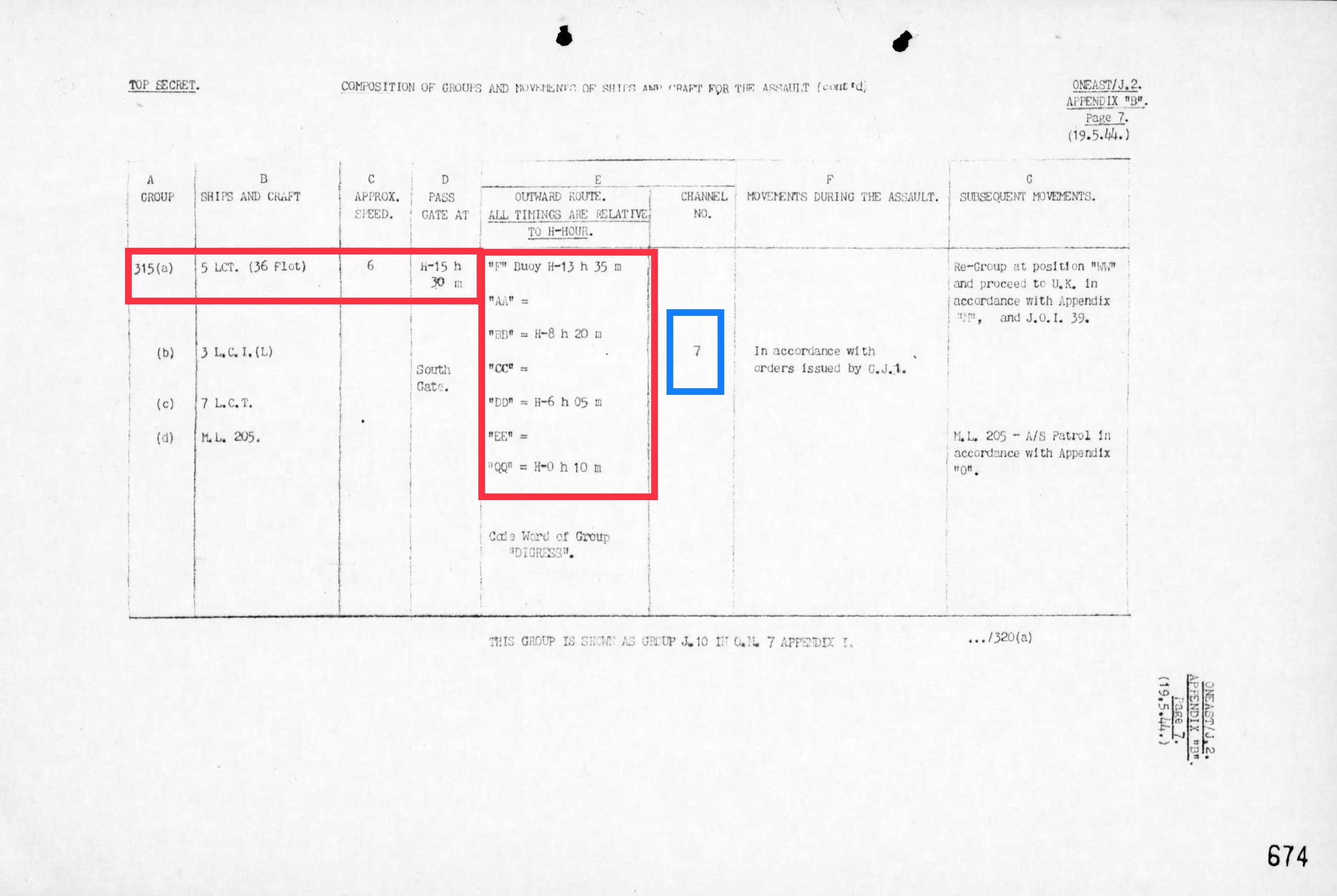
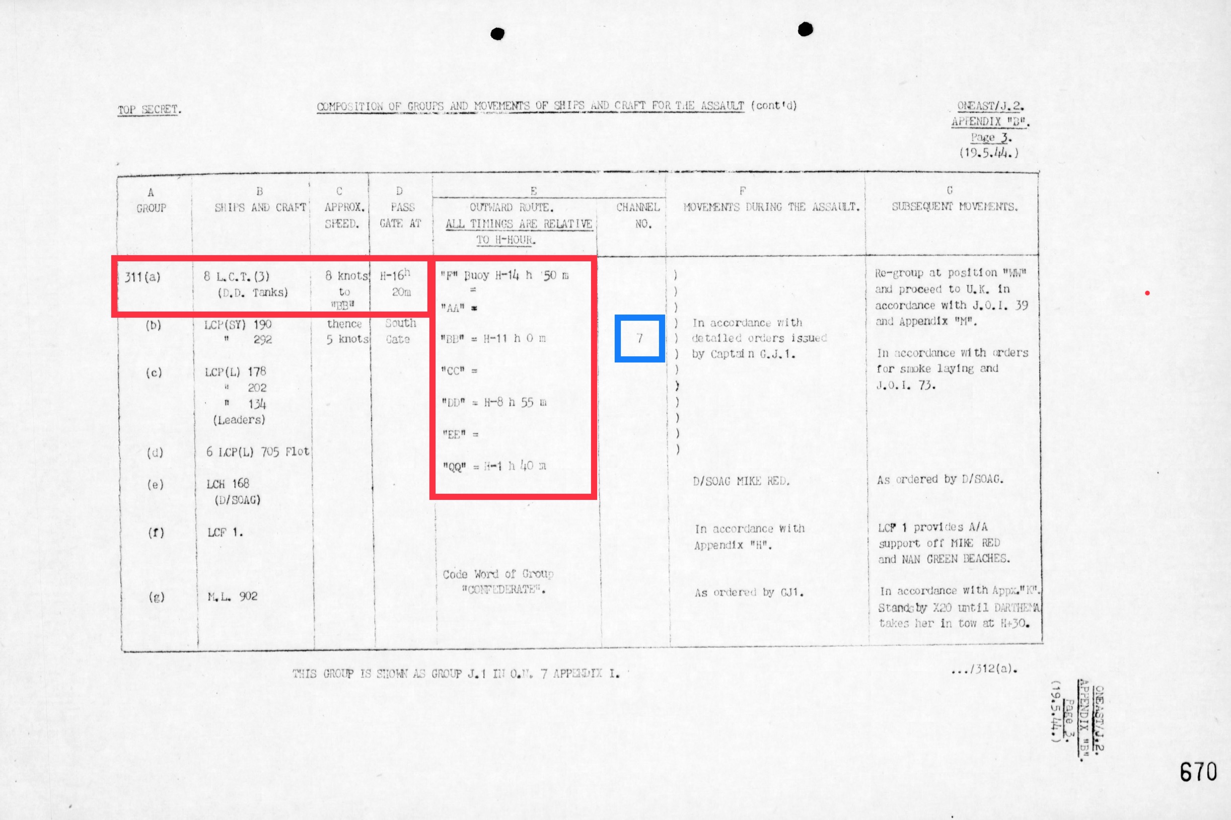
This document shows the DD tanks were in sailing groups J 3 and J 4 for the Mickey Mouse diagrams above
- 0CE289FB-F29F-47EF-A78E-A50428399A7A.jpeg (1.62 MiB) Viewed 27416 times
Re: Map of Force’J’ LST Anchorage Positions in Southampton Area
Posted: Thu Mar 19, 2020 11:23 am
by Temujin
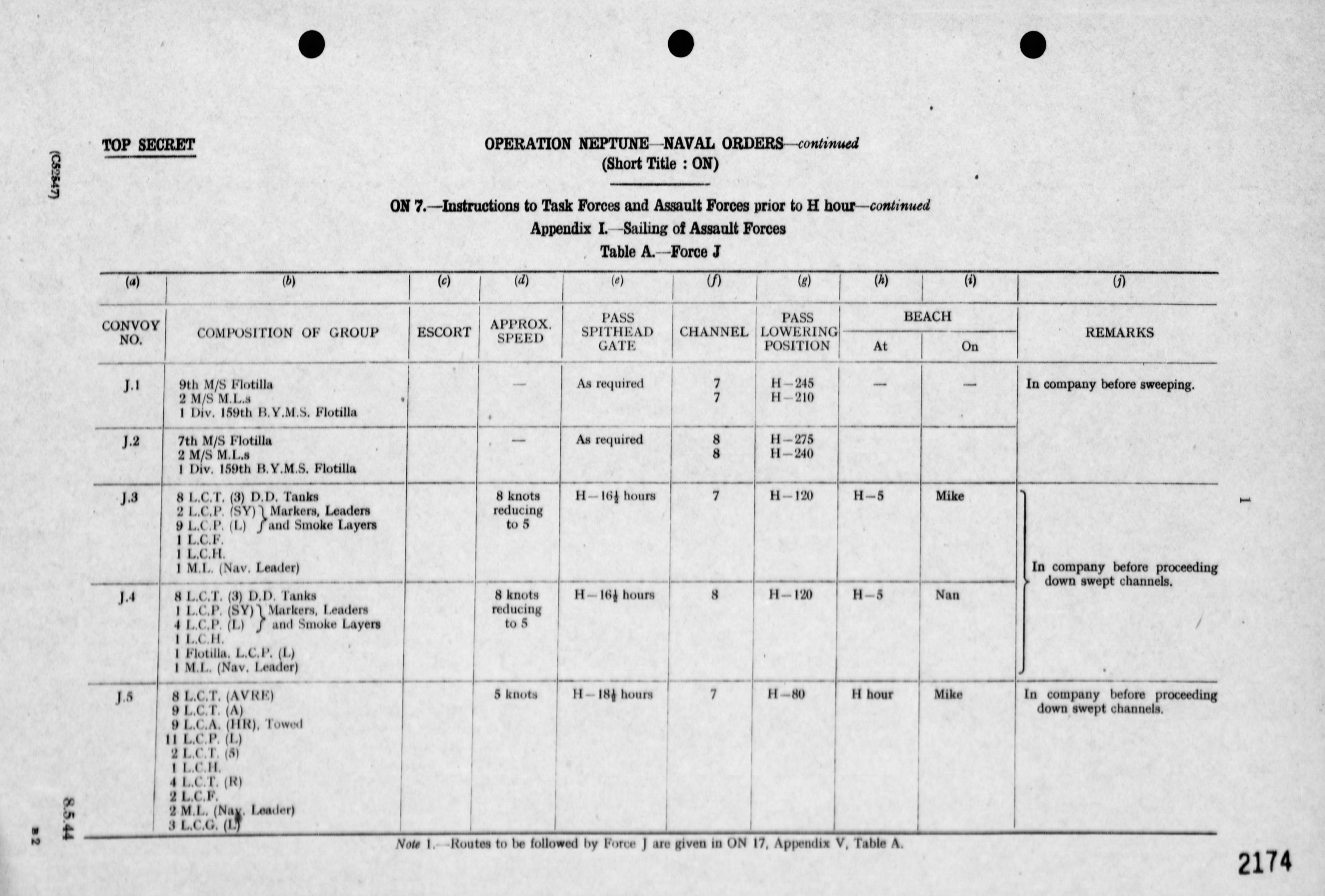
These documents, so you each of the groups, sailing timings, and the timings they were to pass each of the marker bouys and each group was assigned to CHANNEL 7 (this was one of the two channels assigned to FORCE J)
SO, when you look at the first diagram I posted, that shows the CHANNELS for FORCE J......Channel 7 is on the left of the two assigned Channels (Channel 7 and Channel 8)
- 1DE64076-C097-48F5-BB7E-D51319018F73.jpeg (443.76 KiB) Viewed 27418 times
- D80DFB62-5827-477E-ACEE-4803EB34634E.jpeg (505.28 KiB) Viewed 27418 times
Re: Map of Force’J’ LST Anchorage Positions in Southampton Area
Posted: Thu Mar 19, 2020 11:59 am
by Temujin
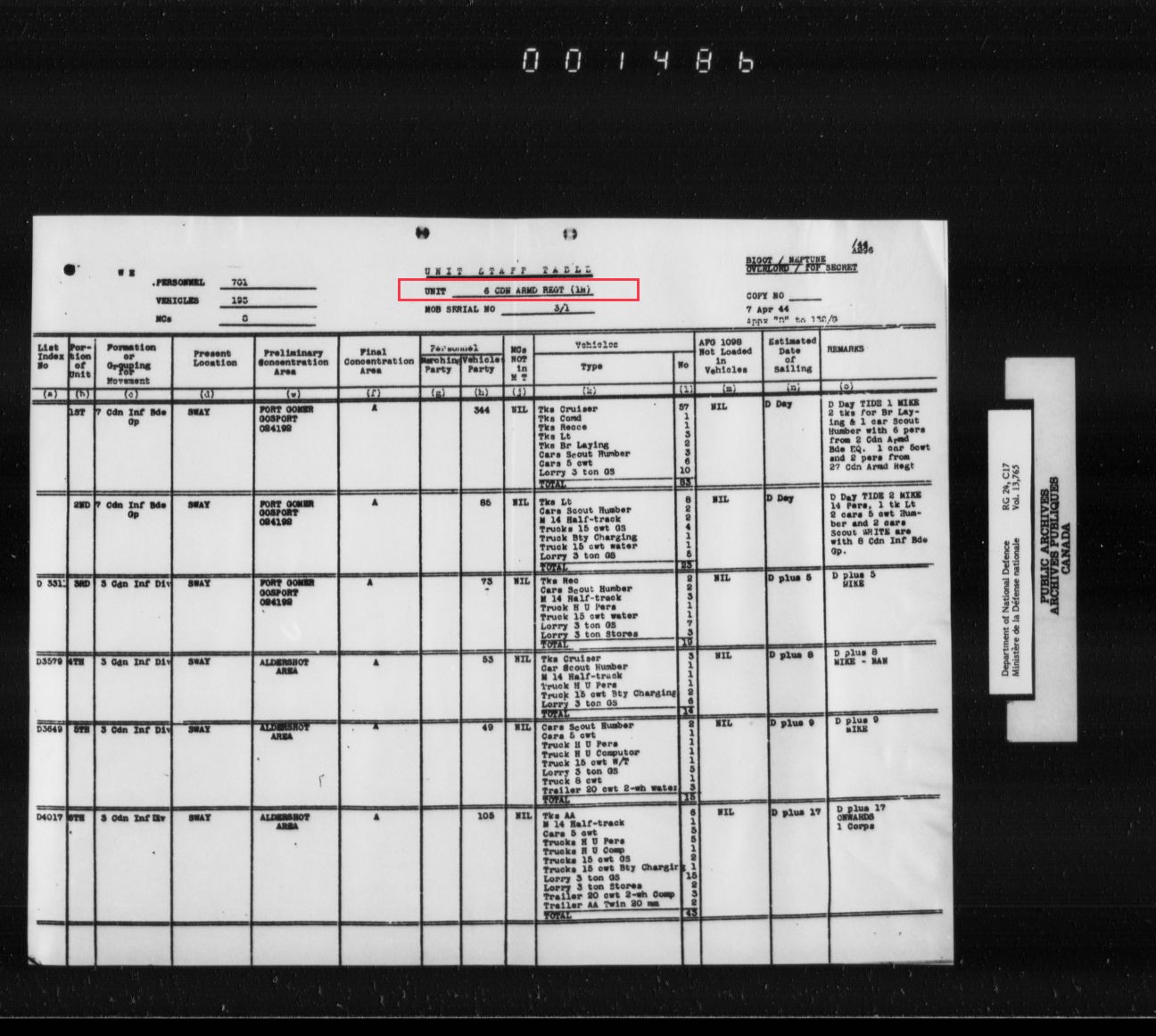
You didn’t ask for this, but this chart shows “where” the 6 CAR was before D Day, which camps it moved to for loading
- 42103E2B-8511-4F85-A027-D5248373D844.jpeg (195.79 KiB) Viewed 27415 times
Re: Map of Force’J’ LST Anchorage Positions in Southampton Area
Posted: Thu Mar 19, 2020 12:05 pm
by CanadianTanker
Temujin, thank you for the staggering amount of information. Time to have a beverage and do some reading. Based on the information that I have and that you have on line, I'm counting 14 LCT's or 5 LCT groups missing in the berthing documentation. Dare I say would it be safe to assume that all of the groups that were to assault would be berthed together?